 The Andes
The Northern Sierra extends northeast from Quito for 140kms to the Colombian border. Along the Panamericana, the main transport artery, the 250km of highway snakes between cloud-piercing mountain peaks, windblown hilltop passes, warm valleys bursting with fruit orchards and flower plantations and a couple of major ecological reserves.
As you head south down the Panamericana from the central highlands, the snowcapped peaks and rumbling volcanoes give way to a softer, gentler landscape of lower elevations and warmer, drier climates. Ecuador’s southern sierra was until recently a very isolated part of the country, with some of the most rewarding and beautiful pockets of Ecuador tucked away here.
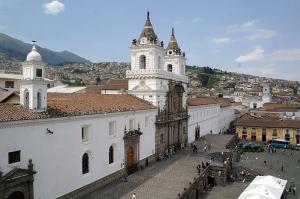
Quito
Overshadowed by Pichincha volcano, Quito is an amalgamation of colonial and Indian influences. With an altitude of over 9,000 feet, the thin Andean air and strong Equatorial sun result in a capital city that moves at its own, rather sedate, pace and is a pleasant place to recover from a long flight and acclimatise to the mountains.
Otavalo and surrounds
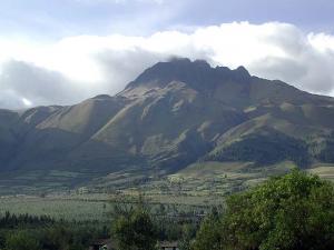
About 100km from Quito, in lovely countryside near San Pablo lake, is the market town of Otavalo. On the way one passes the snow-covered Cayambe volcano, the highest point on the Equator. The famous Otavalo daily market (biggest on Saturdays) is a major attraction with a vast array of produce and handicrafts on show.
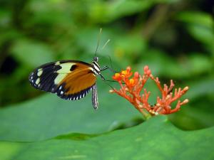
Mindo
Mindo is 2 hours north-west of Quito. Here the 35,000 acre cloud forest, which ranges in elevation from 1,400m to 4,780m, is excellent for birds as well as butterflies and orchids. Although close enough to the city for a day trip, there are many comfortable lodges and walking trails to make a longer stay worthwhile.
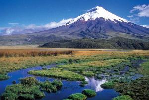
Cotopaxi and Papallacta
About an hour south of Quito is the Cotopaxi National Park, which surrounds the world’s highest active volcano. Near the eastern flank of the park are some large haciendas whose annual cattle round-ups are an attraction for intrepid riders. There are also several important markets, such as Saquisilí, Pujilí and Zumbahua.
Baños and Riobamba
On the northern edge of the Sangay National Park and at the base of Tungurahua volcano is the scruffy pilgrimage town of Baños, popular as a tourist destination for its hydrothermal springs as well as its many adventure activities giving it the reputation as 'the adventure capital of Ecuador'.

Cuenca and Ingapirca
Retaining its old colonial atmosphere Cuenca is one of the most attractive cities in Ecuador, with the historic centre containing churches dating from the 16th and 17th centuries. West from Cuenca is the Cajas National Park, full of glacial lakes set amongst breathtaking scenery at 10,000 feet, an excellent area for walking and bird watching.